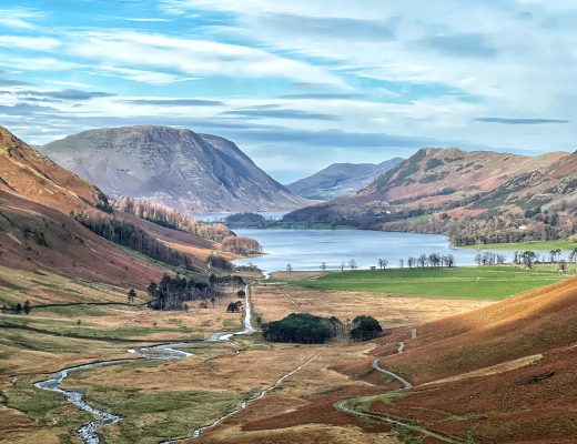
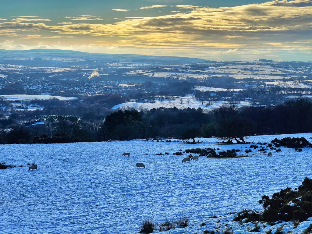
Whether you’re looking for a leisurely amble through woodlands or a hillside hike, I’ll steer you in the right direction of some of the best walks in Lancashire. This part of England is renowned for its wild moors, lush woodlands and glossy reservoirs, perfect for country walks. Choose from short walks or extended rambles through some of the beautiful landscapes of Lancashire.
White Coppice to Great Hill Walk
- Parking: White Coppice Cricket Pavilion car park
- Length: 4.1m
- Grade: moderate
- Time: 2hr 15
During this relatively easy walk you’ll pass historic ruins and enjoy incredible views across Lancashire from the peak of Great Hill.
- Beginning at the cricket pavilion, pass through the kissing gate to go over the bridge that crosses the goit.
- At the end of the bridge, pass through another kissing gate and head left before taking an abrupt right at the old signpost.
- Continue down this path before arriving at a stone wall and some bushes. This site is known as Coppice Stile and these are the ruins of Coppice Stile Farm.
4. Follow the path and turn right when you reach the steps and the old direction sign. After a short time, you will reach the ruins referred to as Drinkwater’s which is believed to have been used for target practice during WWII.
5. Follow the path up to the peak of Great Hill. Here there is a wall in the shape of a cross which provides walkers with protection from heavy winds.
6. Pause to appreciate the spectacular view, including the ancient burial mound to the southwest, known as Round Loaf on Anglezarke Moor.
7. Follow the signpost for Winter Hill before reaching a fence and stile. Climb over the stile and turn right, taking the track towards the ruins of Great Hill Farm.
- With the farm on your right, continue down the path before arriving at some trees that overlook the Dean Black Brook.
- After just 50 yards you will arrive at a stone wall. Turn right, taking the track towards Drinkwater’s Farm.
- On reaching the farm, turn left towards the coppice, turning left at the old signpost.
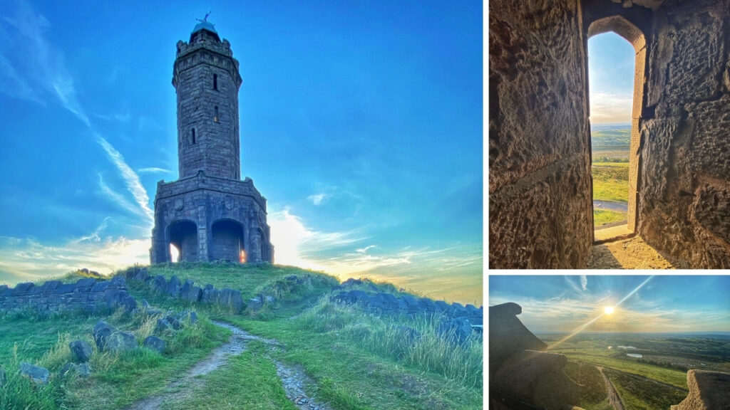
Darwen Tower Walk
- Parking: Sunnyhurst Woods Lychgate Car park
- Length: 2 miles
- Grade: moderate
- Time: 1.5 hrs
Located on Beacon Hill overlooking Darwen, the tower, also known as Jubilee Tower, was built in 1898 in tribute to Queen Victoria’s Diamond Jubilee. It also serves as a monument to the victory of locals who fought for their right to ramble on the moors. This is one of the most famous circular walks in Lancashire.
- Turn right out of the car park and continue down the lane, passing Watermans Cottage. Reaching the fork, stay left and walk up the hill.
- Pass Higher Wenshead Farm on the left before going through a gate. Continuing you will pass through another gate. Follow the track which will bear right. Rather than go right, climb the stile to the left of the gate.
- Continue left and climb the steps leading up the hill. You will be greeted by a stone marker engraved with an image of Darwen Tower and a directional arrow.
- At the top of the steps, go right and continue down the path that leads past the ruins of Stepback Cottage which is known locally as Owd Aggies.
- Follow the path to the top of the hill and turn left at the bench. Here you can enjoy the view of Stepback Clough. A second stone marker is also placed along this path.
- Turn right at the forked path and enjoy the view of Sunnyhurst Reservoir to your left. Continue for a short distance before reaching Darwen Tower to enjoy the view.
- Turn back down the path from which you ascended and continue to the Ordnance Survey triangulation point. From here take the path to the right. You will reach a junction where you will continue straight ahead.
- Follow the path and pass the kissing gate to your right and the water treatment plant at your right.
- Continue straight ahead through the farm gate and when the path forks, take the path to the left. When the path ends, take the path to the left to return to the car park.
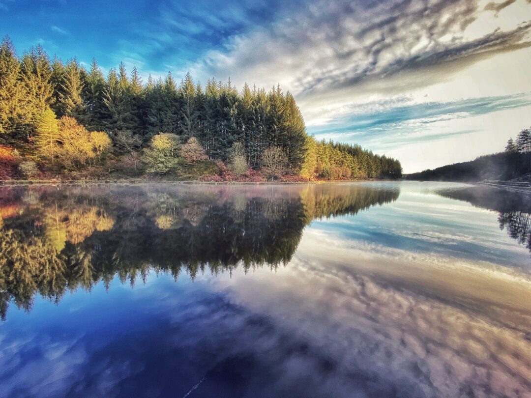
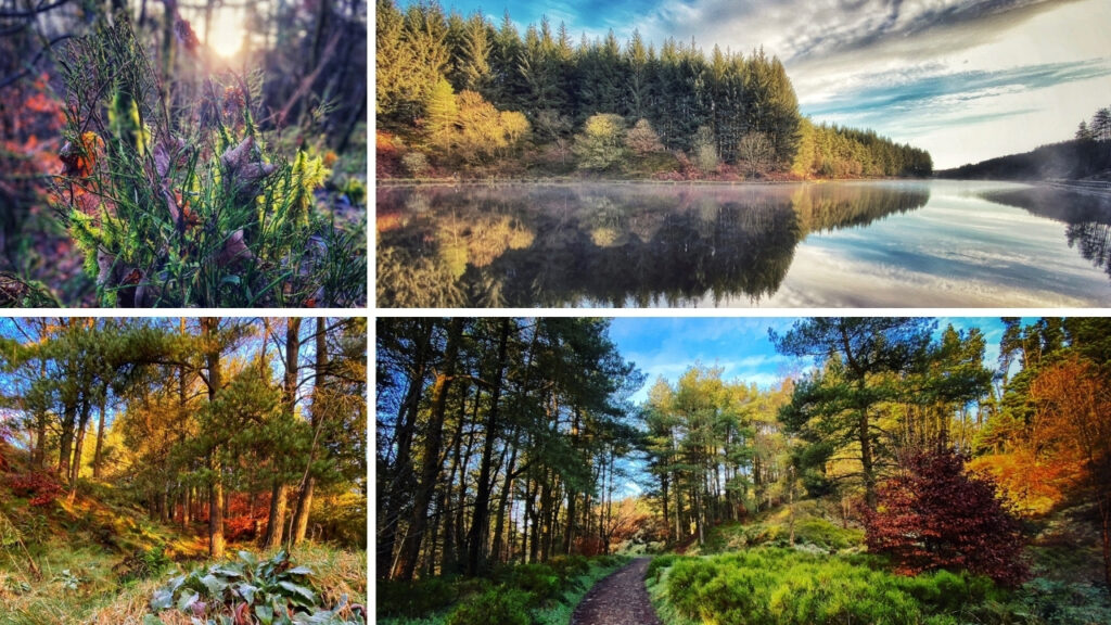
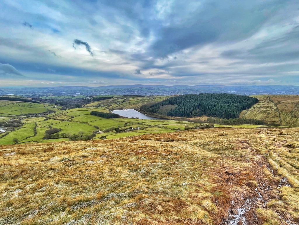
Entwistle Reservoir Circular Walk
- Parking: Batridge Road car park, Edgworth
- Length: 3 miles
- Grade: easy
- Time: 1.5 hrs
This is the perfect walk for those looking for woodland walks in Lancashire. During this route you’ll enjoy a circular walk around the reservoir which is fringed by spectacular towering woodland. The paths are flat making this walk suitable for beginners, wheelchairs, and pushchairs.
- Begin the walk at the gate located opposite the car park entrance
- Walking anti-clockwise around the reservoir, continue for a mile before crossing the footbridge to the northern side of the water.
- The path here leads to a picnicking spot and provides beautiful views of the woodland.
- Walk through the woodland and continue past Entwistle Dam. If you want a refreshment break before continuing to the dam, follow the path up Overshores Road to The Strawbury Duck pub.
- Follow the road around to reach the car park once again.
Rivington Pike Walk
- Parking: Pigeon Tower car park, Belmont Road
- Length: 2 miles
- Grade: medium
- Time: 1.5 hrs
This route is one of the most popular trails, especially on Boxing Day when locals are looking for one of the best walks in Lancashire to burn off the yuletide excesses!
- From the car park choose the path leading south through the woodland.
- Exiting the woodland, you’ll enter Rivington Walled Gardens which has many beautiful spots to explore, including the early 20th century Pigeon Tower and the Japanese gardens and lake.
- After exploring the gardens, follow the steps up to the peak of Rivington Pike and discover the Grade II listed Pike Tower. Enjoy the incredible views from the summit – on a good day you can see as far as Blackpool Tower and the fells of the Lake District.
- Follow one of the many paths that lead to Lever Park before retracing your steps back to the Pike and back down to the car park.
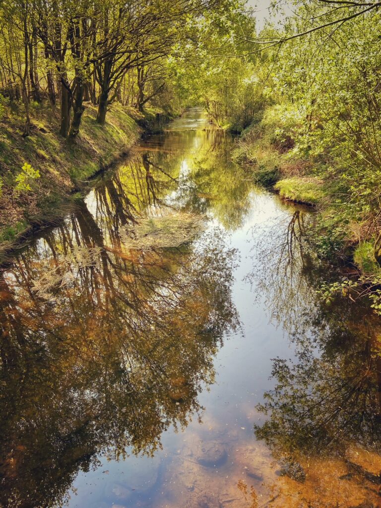
A Cartford Country Walk
- Parking: The Cartford Inn car park, Cartford Lane
- Length: 4 miles
- Grade: easy
- Time: 2 hrs
Make sure you wear your wellies or walking boots for this one as you are certain to come across some very muddy parts along the route!

- Beginning at the entrance of the inn, walk along the river until you reach the end of the car park.
- Follow the river bend away from the inn and enjoy views of the Bowland fells.
- Once you reach the aqueduct and bridge, cross the bridge and turn right.
- Continue past Whitehall Farm which is on your left and follow the rugged path that bears left off Hagg Lane.
- Upon reaching the buildings of Crabtree Farm, climb the stile on the left.
- Cross the field and climb over the stile at the end entering the next field. Cross this field.
- Take a short walk into the next field and turn to your left to discover a gap in the hedge with a stile. Here you’ll discover a beautiful wild garden where the farmer has created a path for walkers.
- Continue down this trail passing the cottages on your left.
- On reaching the junction, turn left onto Lancaster Road.
- Follow the road until you meet a right turn. Take this turn and walk down the long bridleway of Sandy Lane.
- You will pass by a pond and soon reach a metal gate that leads towards the woods. Go through the gate and take the path that turns right.
- Continue until you leave the woods and cross two fields before reaching a farm track.
- Turn left and continue past Crane Hall to your right and Rawcliffe Hall and caravan park to your left.
- Reaching the beginning of Millfield Wood on the right, continue through the gate to the left and head towards the tall trees at the end of the field.
- Here you will reach Rawcliffe Road. Follow the road to Cartford Bridge and cross the bridge to walk back to the inn. The Cartford Inn serves some of the best food in the county so it’s definitely worth stopping here for something to eat.
Witton Country Park and Billinge Hill Walk
- Parking: Witton Country Park
- Length: 3 miles
- Grade: medium
- Time: 1.5 hrs
An invigorating walk through parkland and woodland ending in a short, steep climb to the summit of Billinge Hill where you’ll enjoy sprawling views across the West Pennine Moors and beyond.
- Set off from the car park at Witton Country Park, turning right onto the gravelly track that leads up to the adventure playground.
- Turn left at the playground and continue along the path until you come to a signposted bridleway. Turn right here.
- Walk up through the woods and up the steps at the top, which can be bypassed if you walk around to your right then left.
- Continue up past the woods on the left passing though a couple of gates en route.
- Once you reach the top of the gradually climbing path, you’ll reach a stone wall in front of you with a kissing gate to your left.
- Go through the kissing gate and follow the track to the left for a few yards. You’ll soon come to another path that bends up and around to the right, take this and climb up the short but steep route.
- The path bends round to the left and at the top you then take a left across the field.
- Continue across the field until you reach a fence where you’ll need to cross the stile.
- A small hill comes into sight, continue stright on until you reach the summit where you’ll find the Wainwright Memorial. You might want to take a rest here and take in the incredible views.
- Continue along the bridleway and head towards the woods.
- When you reach the first waymarker, take a right up to a higher path where you’ll fork left.
- Turn right at the next waymarker post to the summit of Billinge Hill.
- Retrace your steps back to the car park.
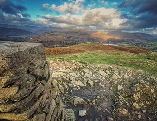
Pendle Hill Walk
- Parking: Barley Village
- Length: 5 miles
- Grade: medium
- Time: 1.5 – 2 hrs
Pendle Hill gained notoriety for its connection to the Pendle Witch Trial back in 1612, but the route up on this Lancashire walk is equally as famous for its spectacular views that stretch across to the Yorkshire Dales and Lakeland fells.
- Set off from Barley Green Lane. Continue up the lane towards the gate that leads on to a footpath across the reservoir dam.
- Continue over the stile into the field which you need to navigate diagonally towards the gateway into Fell Wood.
- Walk down through the woods and then across the footbridge. Follow the path that runs alongside the water and plantation. Head towards the path that leads to Upper Ogden Reservoir.
- Continue up the path to the right and across Ogden Clough. You’ll soon reach a rocky path where you’ll continue the steady ascent to the summit of Pendle Hill.
- Retrace your steps back down the hill and past the reservoirs to the starting point.
If you’ve enjoyed discovering the best walks in Lancashire, take a look at more walks for beginners in the Lake District.